
Appearance
 Remap polygons
Remap polygonsOverview
This node transforms polygon coordinates from a cropped subregion back to the original image's coordinate space. It's used when an AI model processes a small "cutout" but you want to display the results on the full camera view.
Use Remap polygons when:
- You run an AI model on a crop of the original image, and you want to overlay detected bounding boxes onto a dashboard view of the full frame.
💡 Tip
This node requires the polygon_roi parameter that was used to create the original crop to perform the inverse transformation correctly.
Inputs
| Name | Type | Description |
|---|---|---|
| detected_polygons | list[polygon] | The polygons detected within the subregion. |
| polygon_roi | polygon | The subregion defining where the crop was taken from. |
Outputs
| Name | Type | Description |
|---|---|---|
| adjusted_polygons | list[polygon] | The polygons remapped back to the full image coordinates. |
Parameters
This node does not have any configuration parameters.
Example
Displaying crops on full frame
A system crops a specific corner of an image to find small serial numbers. The detected number's polygon is then remapped so it can be shown in its correct relative position on the original 4K image.
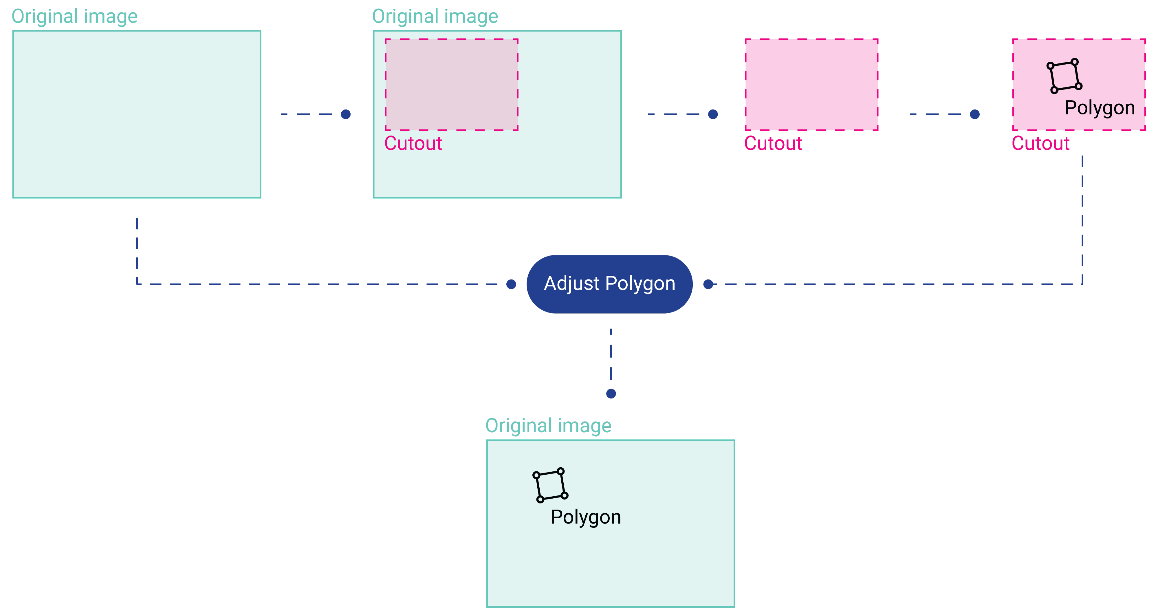
Result: The detection box appears in the correct corner of the full-frame dashboard view.
Related links
Reference:
- Crop Image — creating the original subregion
- Polygon Crop — alternative way to isolate regions
- Resize Image — resizing coordinates after remapping