
Appearance
 Polygon Overlap
Polygon OverlapOverview
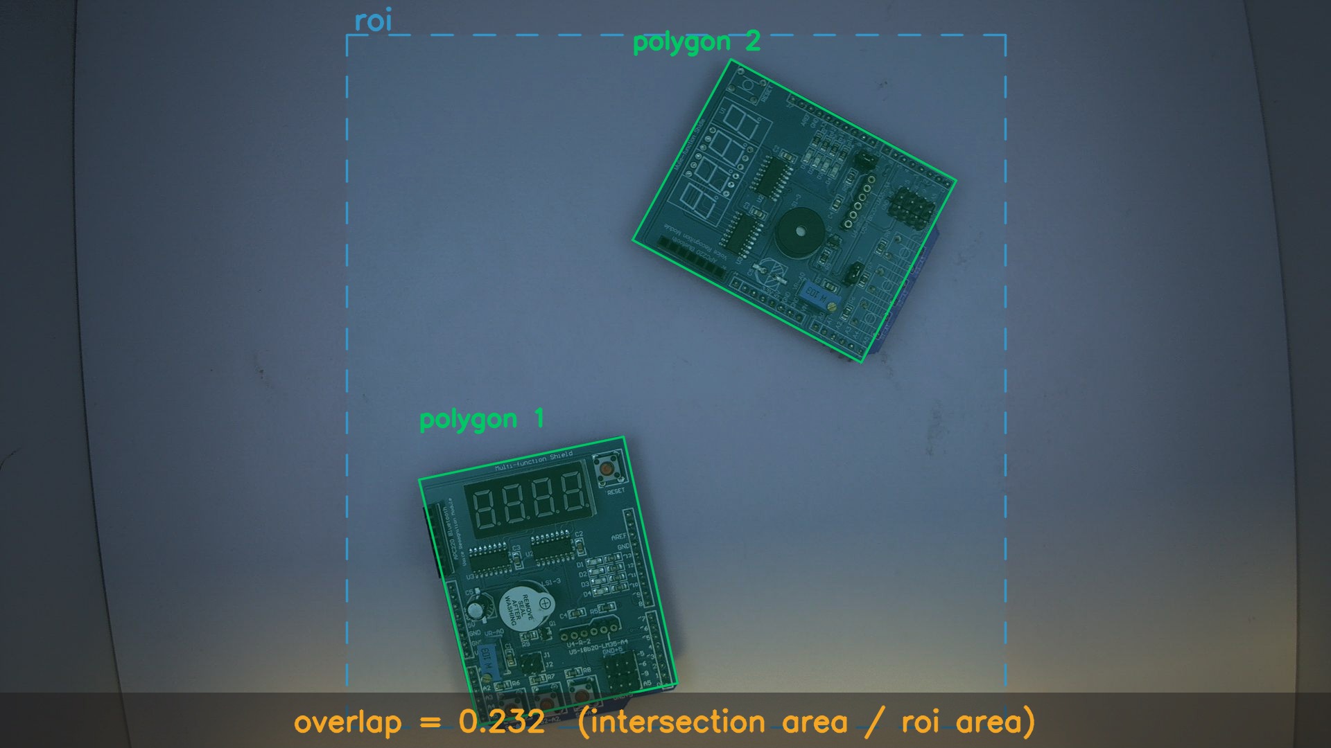
The Polygon Overlap node computes the percentage of a Region of Interest (ROI) that is occupied by one or more polygons.
Use Polygon Overlap when:
- You want to measure what fraction of an area is filled by detected items.
⚠️ Warning
Using a higher resolution will result in more accurate calculation, although it the processing time might significantly increase.
Inputs
| Name | Type | Description |
|---|---|---|
| polygons | list[polygon] | The polygon or list of polygons to check for overlap with the ROI. |
| roi | polygon | The region of interest that defines the target area. |
Outputs
| Name | Type | Description |
|---|---|---|
| overlap | number | Fraction of the ROI covered by the input polygons (0–1). |
Parameters
| Parameter | Default | Valid values | Tunable |
|---|---|---|---|
| Resolution width | 1000 | ≥ 1 | ❌ |
| Resolution height | 1000 | ≥ 1 | ❌ |
Resolution width
The pixel width of the internal rasterization grid used when calculating polygon overlap.
Resolution height
The pixel height of the internal rasterization grid used when calculating polygon overlap.
Example
Checking container fill level
A flow monitors a storage bin (defined as an ROI) and detects items inside it. The Polygon Overlap node calculates what percentage of the bin area is covered by these items.
Configuration:
- Resolution width:
512 - Resolution height:
512
Result: The node outputs 0.232, indicating that roughly 23 % of the ROI is covered by the detected items.
Related links
Reference:
- Polygon Distance — computes distance between two polygons
- Region of Interest — filters detections by a defined ROI
- Dynamic ROI — creates an ROI based on flow data